CV Link is envisioned as a 40-mile, valleywide pathway that is accessible to bicyclists, pedestrians and low-speed electric vehilces. There are currently three segments of CV Link open to ride. The first segment of CV Link runs 2.3 miles between Ramon Road in Cathedral City and Vista Chino in Palm Springs. The second segment of CV Link open is aproximately 1 mile and runs adjacent to Demuth Park in Palm Springs. The third segment of CV Link open is on-street in the City of Palm Desert and consists of 3.5 miles running from the Bump n’ Grind trail head to the College of the Desert and ultimately ending at the wash near Deep Canyon Road. Other segments are being constructed as right-of-way is available. The approved project, as voted on by the CVAG Executive Committee in May 2017, does not include routes through Rancho Mirage or Indian Wells.
Please explore our interactive map and individual city maps below. Click on upper left of the interactive map to view the legend.
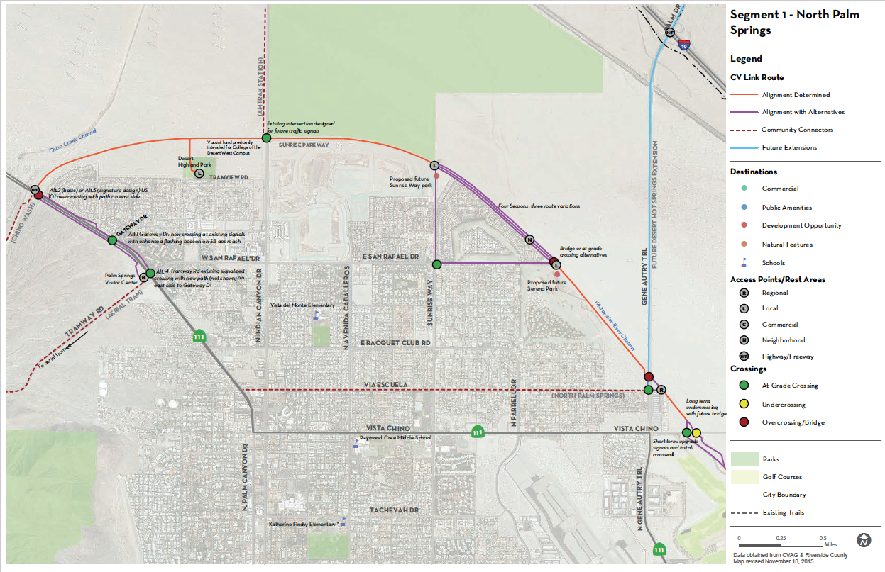
Segment 1 - North Palm Springs
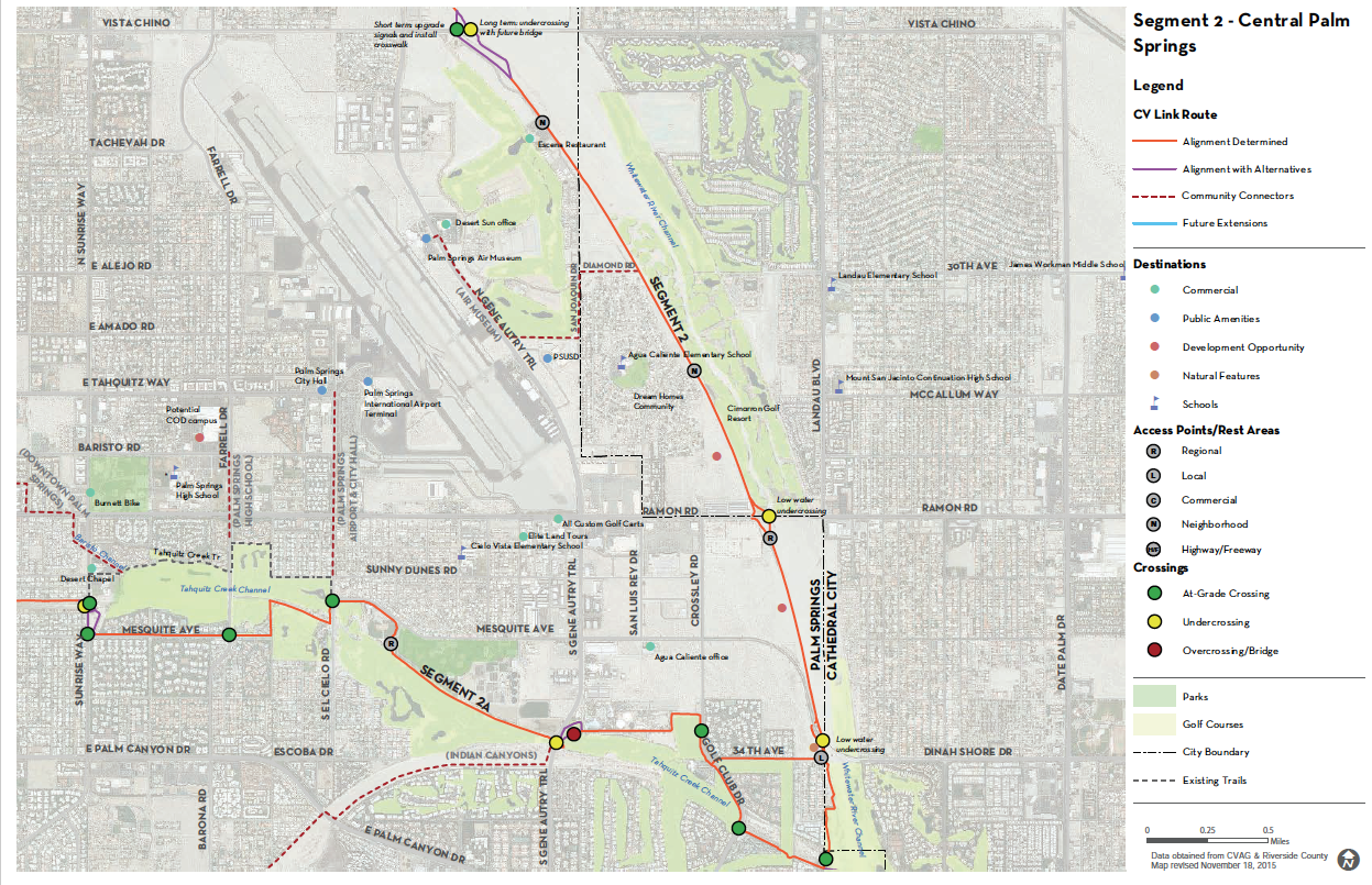
Segment 2 - Central Palm Springs
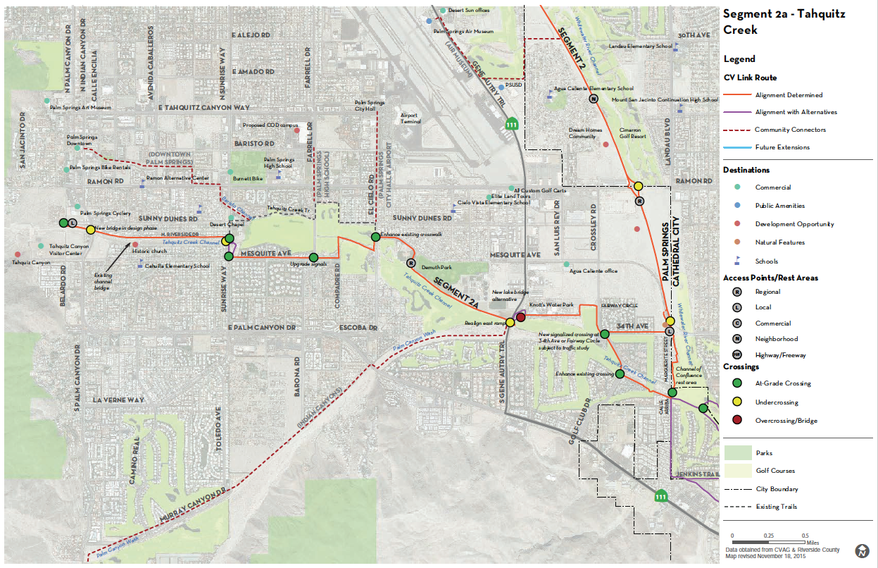
Segment 2A - Tahquitz Creek
Segment 3 - Cathedral City
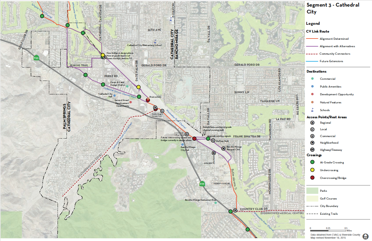
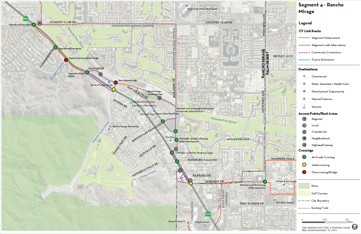
Segment 4 - Rancho Mirage (Not in Approved Project)
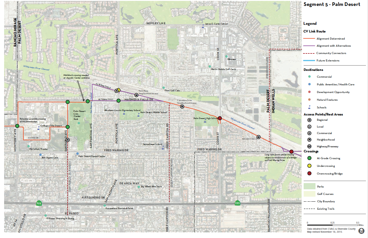
Segment 5 - Palm Desert
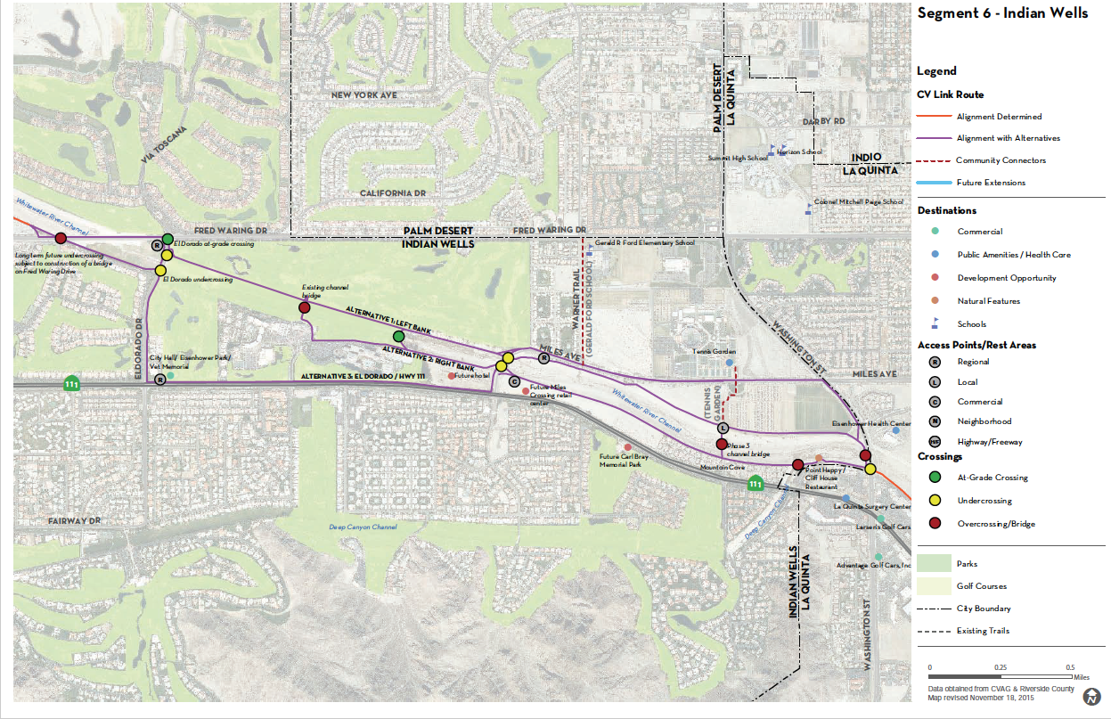
Segment 6 - Indian Wells (Not in Approved Project)
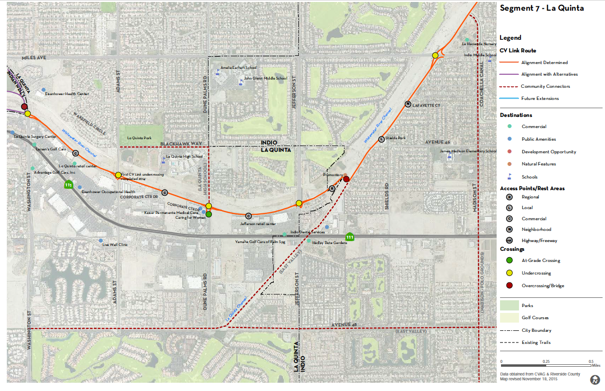
Segment 7 - La Quinta
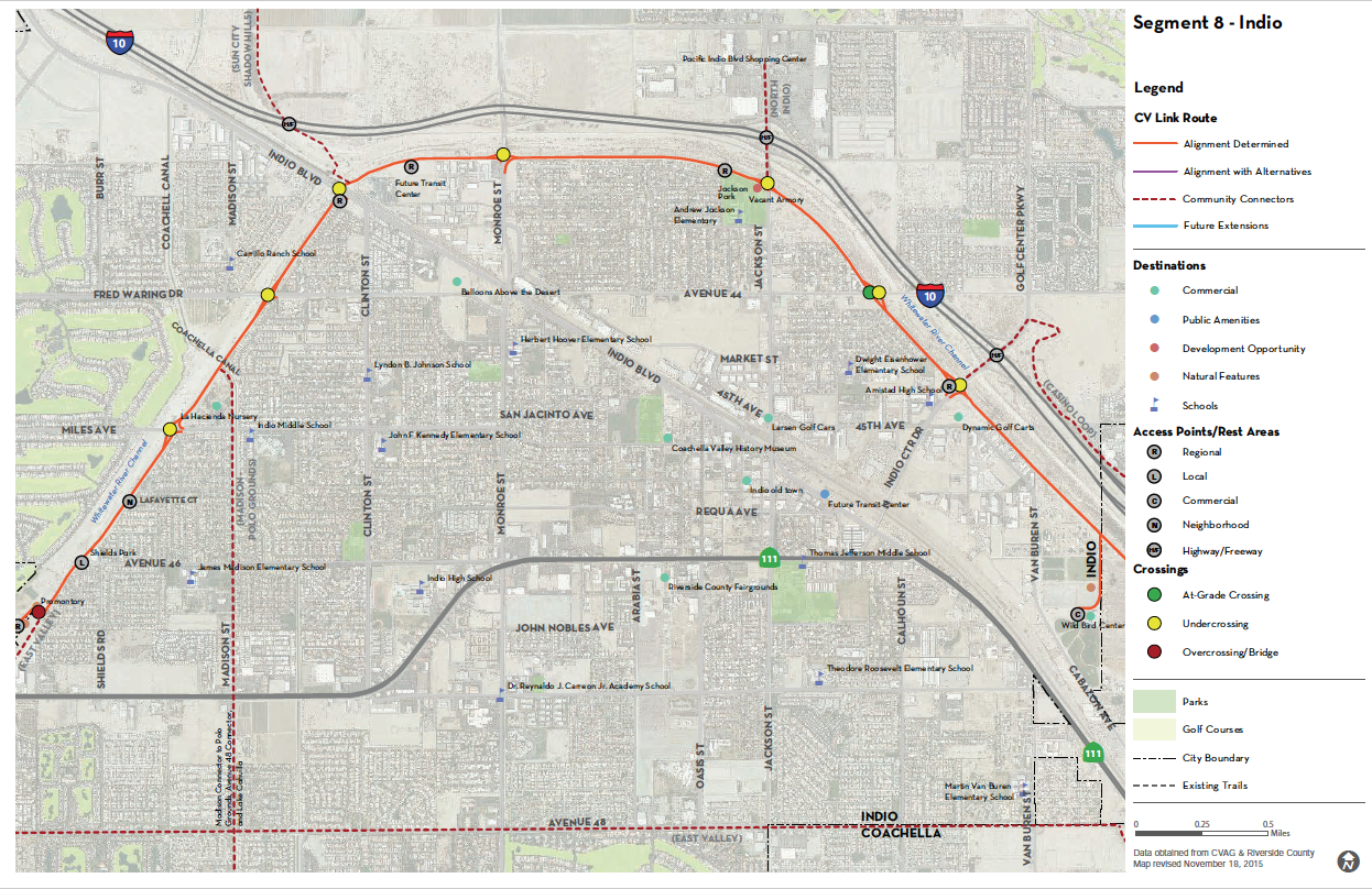
Segment 8 - Indio
Segment 9 - East Native Lands

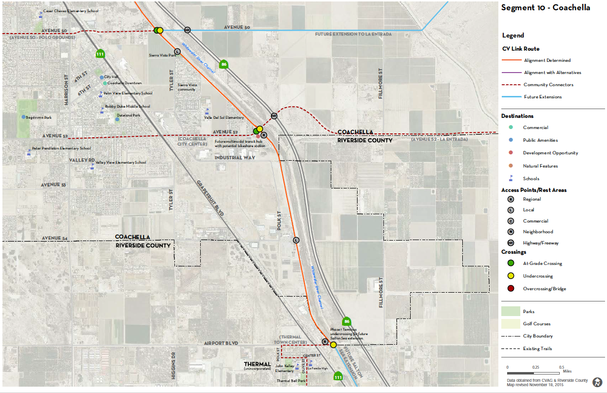
Segment 10 - Coachella
